


| » | » | » | » |
|
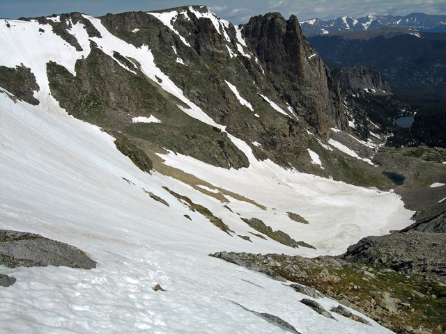
Back on July 6th, 2011, as I climbed the Flattop Mountain East Couloir in Odessa Gorge, I took this shot looking back down the route. Later, as I looked over my photos of that day, I noticed the cool snow couloir across the gorge and immediately decided I would climb it someday. It puzzled me though, that I couldn't find any info on it anywhere, and I wondered if I was missing something. Finally, I found a paragraph on it in Bernard Gillett's book Rocky Mountain National Park: the Climber's Guide - High Peaks This couloir is the left of two called, simply, Notchtop Couloirs (Grade II, AI 2 to 3) located on the north side of Odessa Gorge and just west of Notchtop Mountain. In his book, Bernard referred to the left couloir as "a classic outing of this nature." So after seven years, a few more than I had planned on, it was June 4th, 2018, as I left the Bear Lake Trailhead at 5:30 AM for Odessa Gorge to make the ascent. |
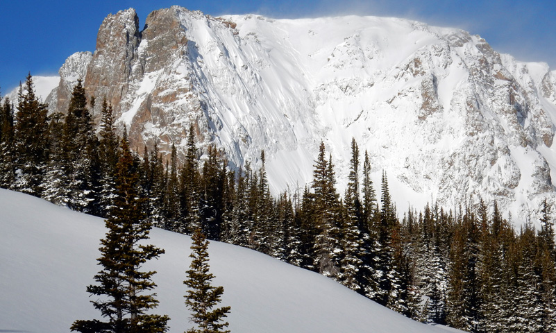
Backing up a couple months, on March 24th, I had attempted to hiked into the gorge for a pre-check of the snow conditions but found more powder snow on the trail than I expected. After taking this awesome shot of Notchtop Mountain with its steep NE face plastered with snow, I turned around. My pre-check was done; it was at least a month too early in the season for the spring snow conditions I wanted.
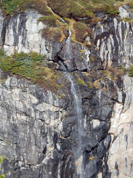
| An hour and forty minutes up the trail, at about 7:10 AM, I was looking at Notchtop Mountain again, but without the snow covered face this time. Scanning the face, I spotted a little waterfall roughly halfway up and zoomed in close for this picture. It was just about time to leave the trail and start the bushwhacking up into the gorge. |
|
At 7:55 AM, I was in the gorge walking up to a little snowmelt pond with the Ptarmigan Fingers couloirs in the background, as shown below. There was a small boulder on the pond’s north side, just beneath the left Notchtop couloir, which made a good place to stop and gear up. I dropped my pack at the boulder right at 8:00 AM.
|
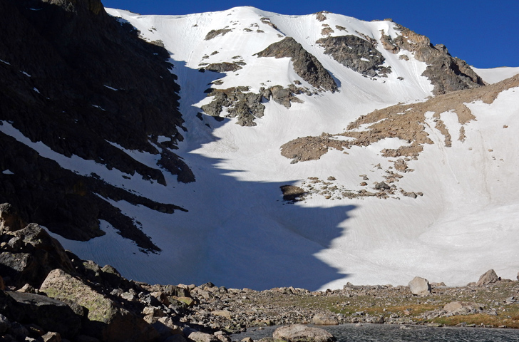
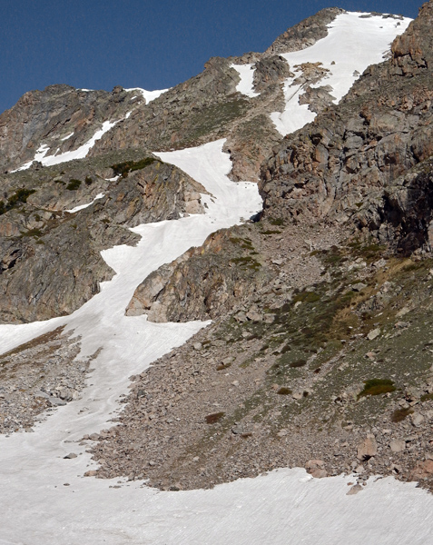
Before gearing up, I had to get a shot looking up the couloir before I forgot. It was interesting how foreshortened
it looked close up like this. Even though I knew it was an illusion, I let myself toy with the idea that this was going to be be a
piece of cake.
My choice of gear for the ascent was:
Mountaineering crampons
Axes: 1 mountaineering (longer shaft), 1 ice (curved shaft)
Climbing harness (to easily anchor to the axes if I needed a break)
Slings 2, with beeners 4
Climbing helmet
|
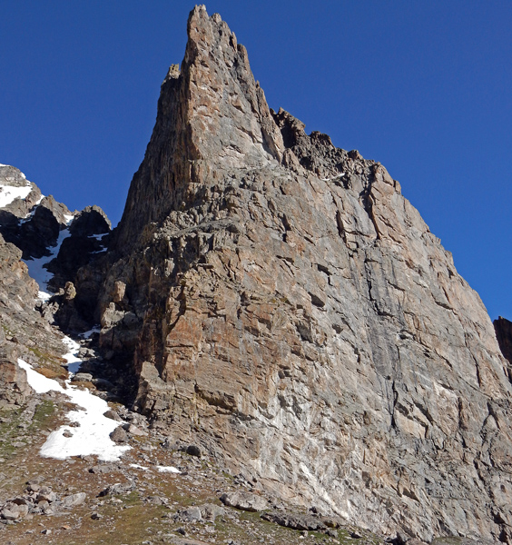
| While it was already mostly melted out, I also got a shot of the right couloir which was right up against the west side of Notchtop Mountain. I'll probably climb it someday, maybe. |
|
|
I had started up the couloir at 8:30 AM, and reached the top 3 and 1/2 hours later just after noon. My last
time at high altitude had been back on September 4th the previous year, which was nine months ago, so I really suffered from
the lack of acclimatization coming up. No matter how much I tried to focus on pacing myself, I was constantly stopping for 20
or 30 seconds to catch my breath.
The angle of ascent was between 40 and 45 degrees most of the way up. A couple times I attempted
steeper areas between 45 and 50 degrees, but the soft mushy snow wouldn't hold my feet at that angle no matter how hard I kicked.
This made the finish, with a slight upturn, a little difficult. I had to work towards the right side, which was also too steep,
and then cut back left to keep the angle under 45 degrees at the gorge rim, as my tracks show in the shot left. I could have
escaped left or right and scrambled up the rocks to finish, but I was trying to avoid that.
Sitting on the gorge rim at last, I was glad that the weather still looked great. I needed a good rest
before starting the long hike back down to the
trailhead. I kicked back and casually eat a lunch Cliff Bar and drank lots of water while a marmot behind me begged for a
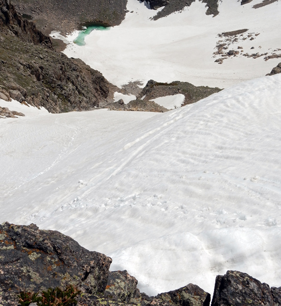
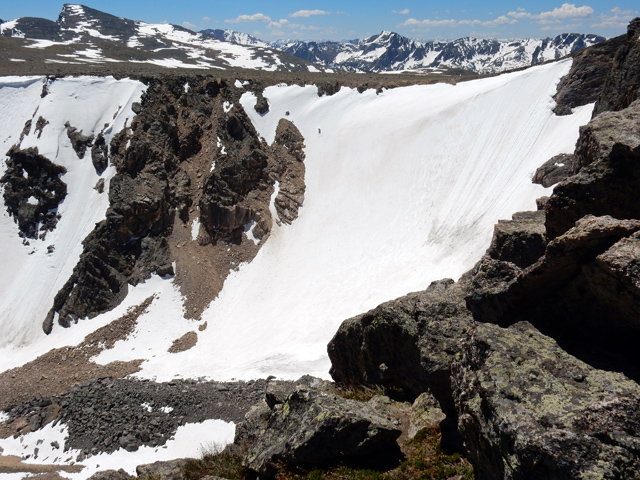
handout but never got it. This shot looking back down the couloir shows the little snowmelt pond below where I had
started the ascent. The GPS showed a vertical gain of 1,265 feet for the ascent. This meant that my rate of ascent was a
humiliating 361.5 vertical feet an hour. My lungs protested,
"No way!" but, yes way.
|
Still at the top of the couloir, I took a shot across the gorge at Ptarmigan Finger again, with Hallett Peak seen behind the summit of Flattop Mountain. While the left (east) finger was my first good snow ascent in late July, 2011, the central and west fingers still intimidate me a little. If we get good snow next year, I might give them a try next spring - but not yet.
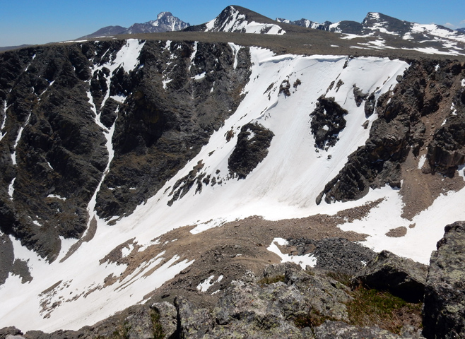
Turning to the end of the gorge (west), I took a shot of Ptarmigan Glacier. I ascended this twice four years ago, alone in late April, and with my son, Steven, in mid-May. However, there was more snow that year, and I don't think it was as steep as it appears now, at least from this angle.
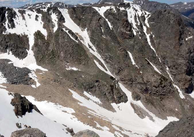
Somewhere around 12:30 PM, I put my pack back on and started around the rim to the Flattop Mountain trail for the hike back down to the trailhead. As I got around to the southeast end of the rim, I stopped for a one more picture looking back across at Notchtop Couloirs. The right (east) couloir looked more interesting from this angle than it did in the morning looking up: it just needs more snow.
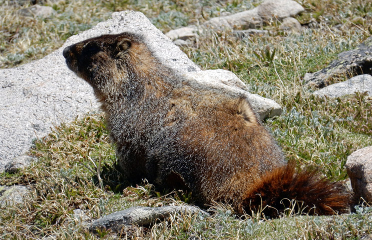
I always enjoy adding a marmot, pika, or some other critter photo to a trip report when I can, which wasn’t hard on this trip. I probably saw six to eight marmots running around near the trail before passing back through timberline into the forest.
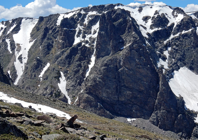
This last picture looks back at Notchtop Mountain with the left couloir at the far left of the shot. Holy avalanche Batman - it looks steep! This should be the shot I show my friends - ha! Ok, now this is where the descent blues creeped in. The fun was over, and my body started to ache as the temperature continued to rise with the drop in altitude. It was 4:30 PM when I finally dropped my pack at the car. Luckily, I had a cooler waiting that Suzy had given me with a big-o sandwich, a vitamin water drink, and a cold beer. Uncharacteristically though, I was so pooped, I had to saved the beer for home.
The GPS stats show a total time out of 10 hours, 56 minutes; a total distance of 10.01 miles; and 3,795 feet of total Elevation gain. My overall average speed was less than one mile an hour.
National Park Service - Rocky Mountain National Park - Climbing and Mountaineering