


| » | » | » | » |
With uncommonly mild winds at the end of January, 2010, I got up at 12 AM, Sunday the 31st, and drove up to the Longs Peak Ranger Station Trailhead. I was going to hike up to the Boulder Field and get some early morning pictures of the Diamond Wall from the saddle between Longs Peak and Mount Lady Washington (the top of Chasm Wall). So, at 2:15 AM, I started up the trail with the light of a nearly full moon directly overhead.
Trail conditions were near perfect right up to Granite Pass where one foot of drift snow covered the trail the rest of the way up to the Boulder Field. I arrived at my destination, at roughly 13,000 feet, a couple hours earlier than expected. My first shot looked southeast, passed the northeast ridge of Mount Meeker, and was just in time to catch the sunrise.
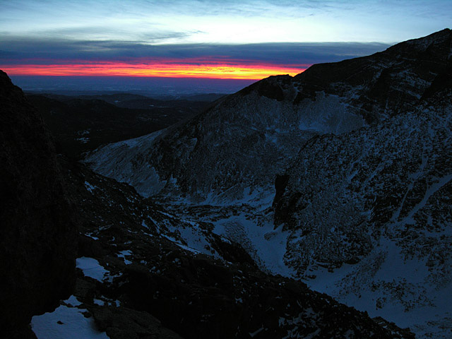
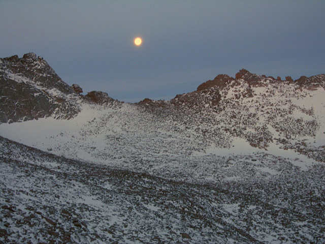
While the wind was a mere whisper, the temperature was still near it's nightly low, and I was getting cold just standing around. I immediately put a windproof shell on over my coat and replaced my damp gloves with dry ones. I needed to wait about an hour for more light, and I had to do a lot of foot stomping and hand slapping to keep from going numb. As I turned to take some shots of the moon over the saddle between Longs and Storm Peak, with the Keyhole visible left of center, the icy cold from the camera soaked right through the gloves, and my fingers went numb again.
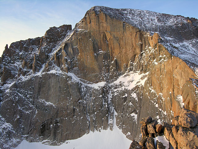
With thin cloud streaks low in the southeastern sky messing with my sunlight, and a need to get my limbs moving again, I settled on this shot of the Diamond at about 7:45 AM. The snow on Boardwalk clearly separates the lower Diagonal Wall (left) and Chasm Wall (right) with the world-renowned Diamond Wall above: first climbed in 1960, by Dave Rearick and Bob Kamps. Zumies Thumb can be seen to the far left. I was glad to start moving again, and set off, rather stiffly, scrambling back down toward the Boulder Field.
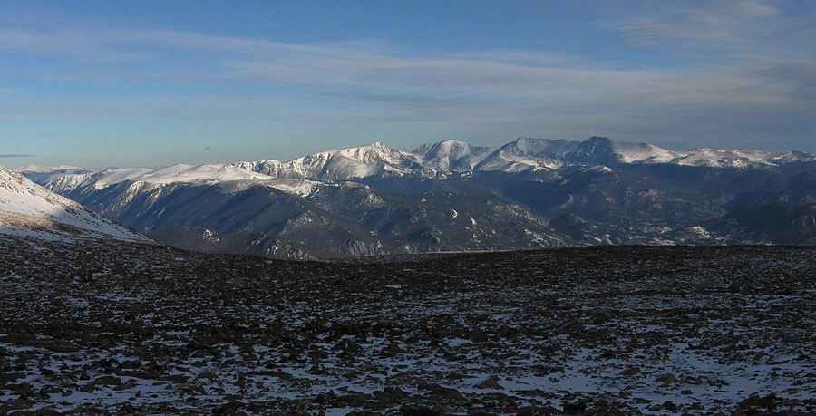
As I neared the Boulder Field, trying to locate the trail through it, the sunlit view of the mountains to the east caught my eye, and I stopped for another shot. Then, seeing the bivouac area outhouses, not far away now, I had to laugh at myself; while I had been slapping my hands and stomping my feet in the dim light on the saddle earlier, I had thought these were two hikers staring up at me, which I found rather annoying after a while. I finally got out my binoculars and saw what they were.
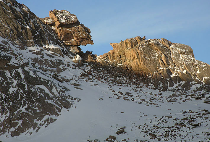
Right after taking the shot above, I turned and saw the Keyhole emerging from the shadows, so I sat around for a few more minutes to get this shot. A fair share of summiteers attempting the Keyhole route up Longs Peak (the standard route) who are still new to 3rd class ascents, get right up to the Keyhole, look down the west slopes, which drop steeply into the Glacier gorge area, and turn around.
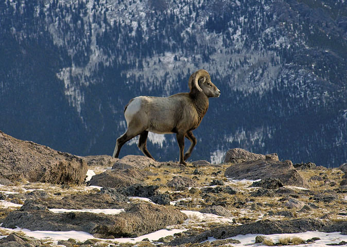
Earlier in the night, as I approached Granite Pass, I was startled by the sudden appearance of firey red eyes in the beam of my headlamp. I had walked right up to a family of Big Horn Sheep. Reluctantly, they cleared the trail as I tried to appear as non-threatening as possible.
So, as I headed back down about 4 hours later, I was surprised to see that they hadn't moved much more than 25 yards. This powerful looking Ram, possible trying to lead me away from the group, walked just ahead along the side of the trail for about a quarter of a mile before angling up the east slopes of Mount Lady Washington.
Nine hours and twenty minutes after leaving the trailhead, I was back. According to the GPS, my round trip distance had been about 12 miles, with a total elevation gain of 3,628 feet. The day had turned out great, and getting the sunrise pictures had been an big bonus. However, when I looked at my watch and realized that is was still morning, 11:35 AM, my only thought was, "Why did I get up so early?!"
Rocky Mountain National Park: Dayhiker's Guide
Hiking Rocky Mountain National Park
