

| » | » | » | » |
Sitting on the summit of Mt Alice in August of 2012, I looked over at Chiefs Head Peak and decided that it would probably be my next summit attempt. However, it was now July 25th, 2014, and I was just getting around to it. Suzy and I have done some great hikes in the last couple years, but this would be my first time above 12,000 feet in that time. So, with a 4:35 AM departure from the Wild Basin Trailhead, I was finally on my way. Knowing the bridge at Ouzel Falls on the Thunder Lake Trail had been taken out by the heavy rains last fall, I had to take the Campsite Shortcut Trail: a rougher trail, but seven tenths of a mile shorter anyway. Two and a half hours up the trail, I came across this Ptarmigan and two or three chicks running around in the brush. The chicks were too fast for me though, and the only good shot I got was of mom.

Another hour further up the trail, at 8:00 AM, I took this scenic shot with Mt Alice in the background. I had hiked up this way a month prior, but through deep wet snow, and I hadn't reached this point until about 10:00 AM. I felt good about my pace and hoped to be well on my way back down before noon to avoid any chance of getting caught high with afternoon storm activity.

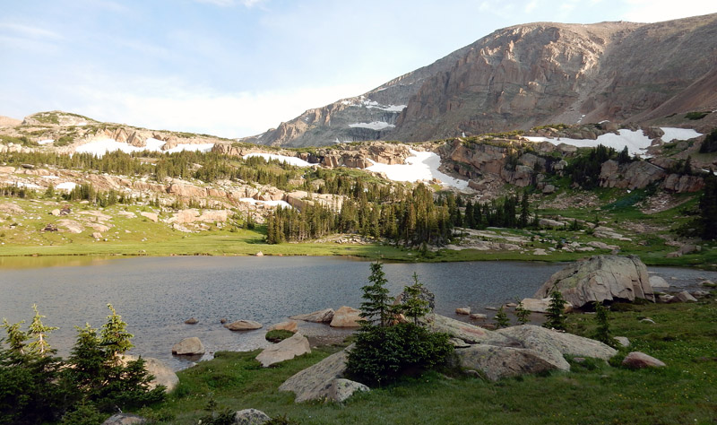
Just 5 minutes later, I was at Lions Lake #1 and getting a shot with Chiefs Head in the background. This is where the trail starts to peter out though, and spotting cairns - assumed to be the path of least resistance - becomes a monotonous job.

At 8:30 AM, I stopped for a picture of Trio Falls, but when I got home and looked at the shot, there appears to have been a mosquito on the lens. At least that’s one that wasn’t getting my blood.

With all the rock hopping, and at about 12,500 feet in elevation now, my pace was slowing to a crawl. At about 10:25 AM, I was still about 3/4 of a mile and 1,000 vertical feet from the summit. I took a quick look around for any signs of weather coming in, and then looked up the long west slopes to the west ridge and slowly moved on.

I like this shot of the upper north face of Chiefs Head, with Pagoda and Mt Meeker in the background. At the time though, I had just come up over a false summit, and realizing I still had two to three hundred vertical feet and about twenty minutes to go, my appreciation of the view was limited. I believe it was here where the ridge narrowed briefly to about 15 feet or so, and I carefully checked it out to be sure the rock was secure enough before I continued.

I finally reached the summit right about noon, and this shot, looking east along the ridge towards Pagoda Mountain, followed by Longs Peak and Mt Meeker, was the view I wanted. Something odd was going on though; the sound of an aircraft engine echoed all through the Glacier Gorge, on the north side of Chiefs Head. I looked around for the source, but I couldn't see anything.

I wanted a picture of the Longs Peak Keyhole and the Keyhole Route trail crossing the steep wall on its right, but I was zoomed in pretty tight, and was having trouble keeping the camera steady enough for the shot. I got the shots and looking around again, I saw a rescue helicopter flying out of the gorge. It was the next morning when I realized that one of the Keyhole shots captured the helicopter with a basket hanging below. With an Internet search, I found, sadly, that this had been a body recovery.

I ate a Cliff bar for lunch and then carefully slid over to the edge of the north face to get a shot looking down at Spearhead. It really looked broken up from this side: nothing like the view of its north and east sides with some great technical climbing routes.

After 30 minutes on the summit, I looked around and saw more scatter clouds than there were when I first arrived, and I knew it was risky to stay any longer, so I started back down at 12:30 PM. Twenty minutes after leaving, I looked over at Mt Alice and the Hourglass Ridge. I had forgotten to take a shot looking that direction from the summit, so I stopped here before I lost any more altitude.

I was down off of Chiefs Head but still above timberline when I saw the storm coming in over the Hourglass Ridge. The lightning and thunder activity was still on the west side of the ridge, but I wasn't poking around anyway. When the rains finally hit, I was just getting back down into some thin sections of trees. The storm never amounted to much though, and I was out of it about 30 minutes later. It rained lightly, off and on, most of the way out, but it felt pretty good and I kept my rainjacket off through most of it. About 10 minutes from the trailhead, right at 7:00 PM, I got this photo of the rainbow to the east.

The GPS recorded a total distance of 18.22 miles, a total ascent of 5,226 feet, and a max elevation of 13,602 feet above sea level (only 23 feet off of the official summit height of 13,579 feet). The entire trip took a mere 14 hours and 44 minutes. OK, that time is a little embarrassing, but in my defense, I did have to stop to pump more water coming out which took at least 15 minutes.
National Park Service - Rocky Mountain National Park - Climbing and Mountaineering