


| » | » | » | » |
With career related goals taking up most of my time for over a year now, it's been 11 months since I've done anything much above 6,000 ft. So, when I got out and worked my way up to Chasm Lake last Friday, with too much gear I might add, I was suffering. Now (June 18th, 2012), after a couple days rest, I took off from the Lawn Lake Trailhead at 4:20 AM for Ypsilon Mountain. My goal was vague; I would have been happy just to get there and take a few pictures, but if I could hang in there, I wanted to ascent Mount Chiquita's East Ridge and summit both Chiquita (13,069 ft.) and Ypsilon Mountain (13,514 ft.).
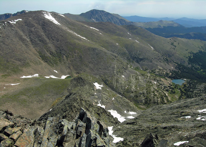
At the highpoint on the trail, short of Chipmunk Lake, I turned west and started bushwhacking through the forest and rock hopping above timberline until I reached the east ridge of Mount Chiquita. As I looked down the west and east side, and up the ridge, I knew it was going to be a long fun day. This early morning shot of Ypsilon Mountain was taken on my way up to the East Ridge of Chiquita.

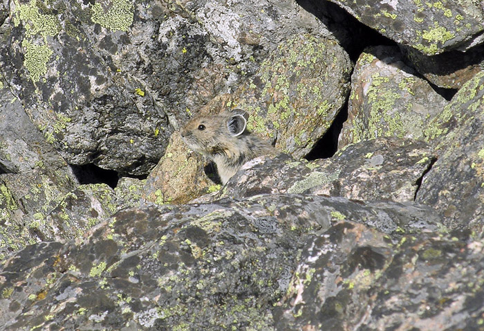
It doesn't matter how you do a 2:30 AM breakfast, it won't last until noon, so at about 8:40 AM, I stopped for a breakfast Cliff Bar. This pika was checking me out through most of the break, which allowed me to get my fist pika shot. They are a little hyper and normally disappear before I get the lens cover off the camera.
I tagged the summit of Chiquita and, stopping only long enough to catch my breath, I descended north, over to the southwest slope of Ypsilon. Reaching the summit at about 10:20 AM, I was shocked to see my GPS reading an accumulative elevation gain of 6,098 ft. from the trailhead. Wow! I must have acclimatized really well after the Chasm Lake hike; although, I'm sure cutting much of the weight in my pack helped too.
The summit shot looks east, with Ypsilon Lake on the right and Mummy Mountain in the background. Directly behind Mummy Mountain, smoke from the ongoing tragic High Park fire, just northwest of Fort Collins, is visible. In fact, the whole eastern skyline was pretty much all smoke. Living only about 15 miles from the south end of the fire has made breathing really unpleasant the last couple weeks, depending on the wind direction.
|
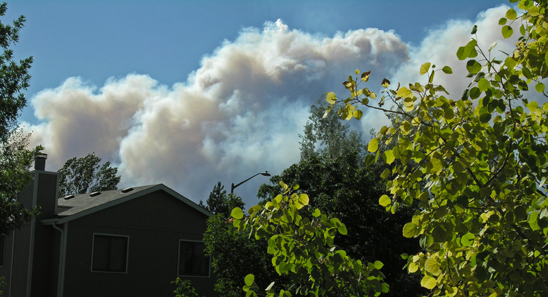
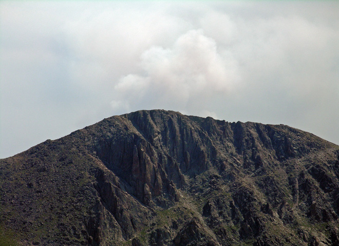
I put the telephoto lens on for another shot of the smoke coming up from behind Mummy Mountain. Also, click the thumbnail image on the left for a look at the fire as it was seen from Fort Collins, June 10th 2012, less than a day after it was started by a lightning strike. With the current drought conditions in the western US, and this being the 2nd fire already this year just in the Fort Collins area, it's going to be a long tense summer. |
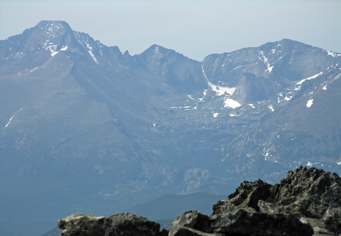
With the telephoto lens still on, I turn and took a shot looking south now into the awesome Glacier Gorge. This should have been a great shot, but with the wind blowing southwest this day, the area was covered with a thick smoky haze.
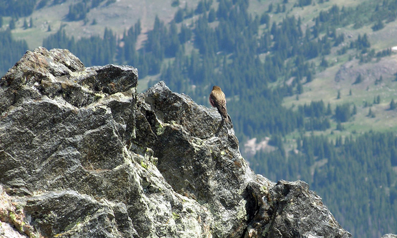
After a while, to my left (north) I finally noticed that I wasn't alone on the summit. If not for the view, what other reason could a bird possibly have for flying up to and resting on the top of a mountain.
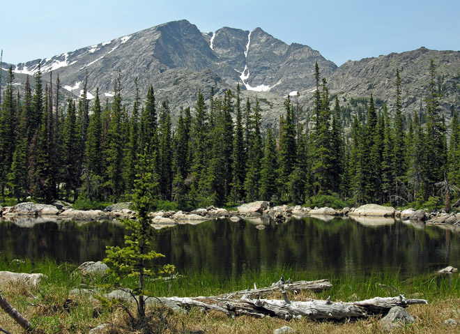
Knowing I had a lot of ground to cover getting back down, I left the summit after only 25 minutes. Rock-hopping downhill is really monotonous, and eventually I felt the irritation of a blister growing in the ball of my foot. After a couple hours, I was down to timberline, and with a short but tricky bushwhack down through the forest, I would be back on the trail. I made it through this section fairly easily going up in the morning, so I pulled out my GPS, planning to follow my track in reverse; however, I had apparently turned off the tracking feature on a previous trip, for some reason, and never turned it back on. Without the track to follow, I drifted left (north) onto some uncomfortably steep terrain and intersected the path on the wrong side of Chipmunk Lake. It was a great day though, and as I passed the lake, I stopped for a final shot looking back up at Ypsilon Mountain.
Stats: per the GPS, my round trip time was 11 hours, 40 minutes, with a total distance of 15 miles: the error coming down through the forest cost me an additional half mile. With the added elevation gain of going over Mount Chiquita (and a couple other minor rises on the ridge) twice, along with the short hike back up from Chipmunk Lake, my total elevation gain for the day was 7,420 ft.
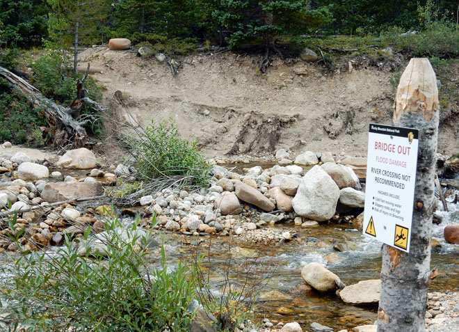
*** Update: on a hike up to Lawn Lake on September 4th, 2014, Suzy and I took the short detour over to the bridge crossing the Roaring River at the start of the Ypsilon Lake Trail. We knew that some of the bridges in the park had been washed out or damaged last September with heavy rains, so we wanted to see if this bridge had been affected. As the picture shows, with steps visible on the far bank, the bridge is definitely out.
National Park Service - Rocky Mountain National Park - Climbing and Mountaineering
