


| » | » | » | » |
When Suzy and I planned this trip into the San Juan Mountains' Chicago Basin, north of Durango, Colorado, our goal was to bag all three 14ers there in four days. It was a long drive down to the southwest corner of the state, and we really wanted to avoid having to do it for each peak. We did successfully make it up Windom Peak, however the snow conditions were worse than we had expected, and we ended up backing off on our attempts of Mount Eolus and Sunlight Peak because of it. Questioning some of the locals about the amount of snow they had received in the mountains this last winter, we were told that the snowfall wasn't that much out of the ordinary, but with below average temperatures through May, the spring thaw was late in coming.
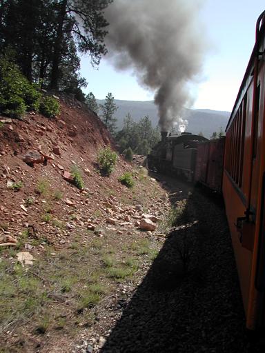
Anyway, we began the July 4th weekend, 2005, by driving down to Durango on the 2nd and catching the " Durango & Silverton Narrow Gauge Railroad" to the Needleton Trailhead on the 3rd. Suzy took this shot of the train going around a bend, by extending her arms and camera out the window, which isn't allowed and we’re sorry. The train ride up into the mountains was fun, but on the train back out three days later, in the heat of the afternoon, the wind brought a lot of the smoke and soot back toward the passenger cars and in through the windows. With the help of a couple cold beers though, we were able to cope with it.
This is about all there is to the Needleton stop: nothing but a trailhead really, sitting at just above 8,200 feet.

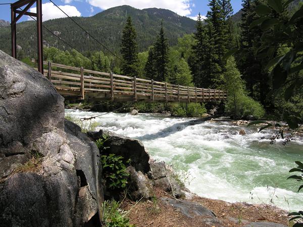
The bridge at Needleton crosses the Animas River and starts the long hard six to seven mile uphill hike into the Chicago Basin. Lucky for us, about an hour up the trail some clouds with light rain started rolling in, lowering the temperature to a more comfortable level.
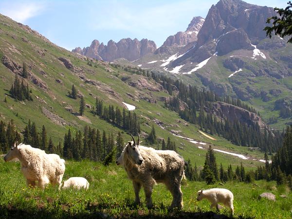
Mountain Goats are everywhere in the Chicago Basin, and due to the train approach to the Needleton Trailhead that most people use, there are almost no dogs around to run them off. In fact, just about all the wildlife here, Mtn Goats, dear, and Marmots included, are almost too comfortable around people. Marmots regularly tear into packs and tents, while the Mtn Goats like to hang close and, attracted by the salt, fight each other for the right to lick the ground after you pee.
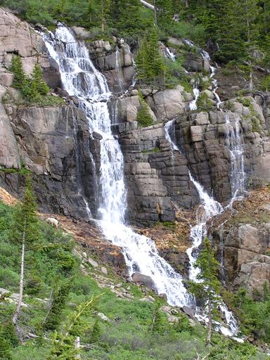
The West Ridge Route on Windom Peak, a classic, is the easiest route up any of the three 14ers here, so we chose to hit Windom first and evaluate Eolus and Sunlight along the way. The start up to Twin Lakes from Chicago Basin has been rerouted for some reason, but with our eyes looking up at the mountains instead of on the trail, we missed the turn. Looking down in confusion at the small log over the old trail, we finally stepped over it and continued on up; once again, we're sorry. Our shot of this beautiful waterfall was taken on the way up the old trail.
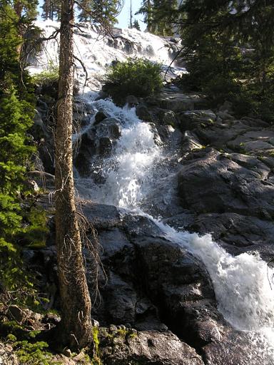
This waterfall, near treeline, was off to the east of where the old and new trails coming up from Chicago Basin merge.
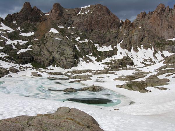
It was noon when we finally made it up to Twin Lakes. I was extremely disappointed at how slow we were moving, even though the group ahead of us didn't seem to be moving any faster. With all the snow ahead and clouds rolling in, we were convinced that we weren't going make the summit. With no need to turn around just yet though, we continued up just for the fun of it. This shot of Twin Lakes was actually taken on our way back down though.
As we approached the steeper snow along the north side of Windom's west ridge, we were just about ready to turn back; however, seeing the group ahead just short of the ridge now, we took another look at the clouds and cautiously kept going.
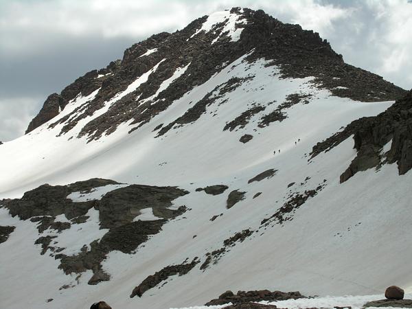
Well up on the ridge now and only about 30 minutes from the summit, we started getting our hopes up. It was 2pm, and while we watched the clouds nervously, there just didn't seem to be any real storm activity building. To speed things up, we were going to drop our packs for the final run to the summit. As soon as we put them down though (what did I say earlier), not even waiting for us to leave, two marmots came running up surprisingly close with evil written all over their faces. We put the packs back on, while I grumbled and took this shot, and continued on up. Suzy did eventually drop her pack just short the summit as the ridge, with patches of snow, got a little spooky pushing the upper limit of its class 2+ rating. As we expected though, when we returned just 20 minutes later, there was another marmot standing on the pack trying to get in.
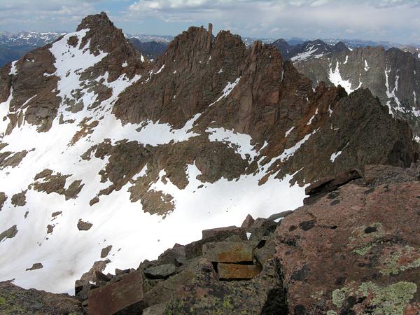
Five hours after leaving camp, we summitted Windom Peak at roughly 2:30 in the afternoon. Still feeling uncomfortable with the weather, we stayed just long enough to get the next couple shots and then started back down. This photo shows the south side of Sunlight Peak and Sunlight Spire, holding more snow than we wanted to deal with. While we had heard rumors that a group had recently summitted Sunlight, no one made an attempt during the three days we were there.
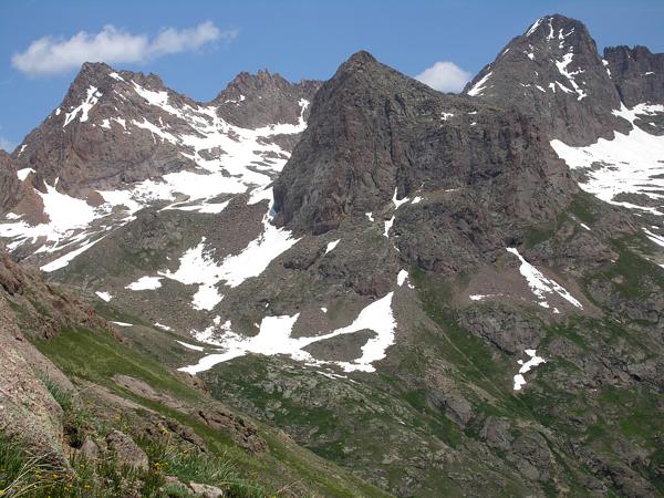
Looking west at Mount Eolus, we saw very little hope in a summit attempt on either peak. The next day we met a couple guys heading up Eolus, but found them unsuccessfully retreating early in the afternoon. To our knowledge, and that of the rangers we talked to, no one had summitted Mount Eolus so far this season.
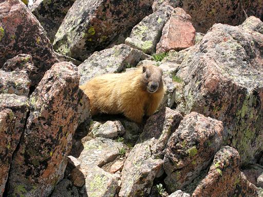
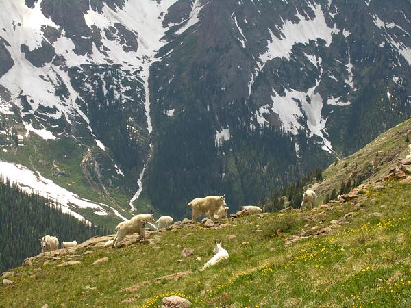
The day after summitting Windom Peak, with no more plans to attempt the other two 14ers, we hiked up the south side of the first false summit of Mount Eolus to about 12,000 feet, and worked across to the southeast finger of the south ridge. The goats in the photo below looked a little upset until they saw that we weren't going to run them off their lounging platform, and were content to let us have the smaller one higher up.
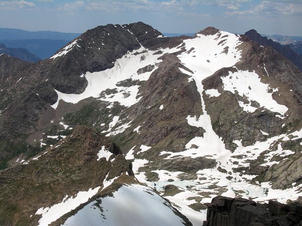
Sitting just up from the Mtn Goats and looking off to the west, we had this view of Windom Peak on the right with its west ridge leading down to Peak 18 at 13,472 feet, and Sunlight Peak to the left with Sunlight Spire further back reaching 13,995 feet. I couldn't help wondering if the goats below were just enjoying the great exposure to the sun or whether they were up here, as we were, enjoying the beautiful mountain scenery.
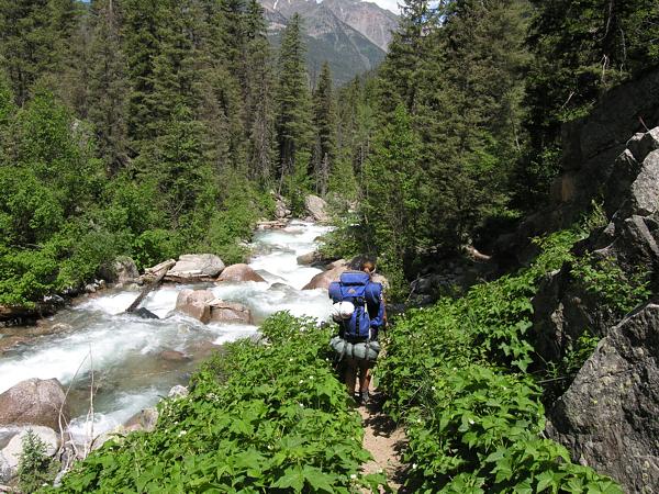
I was not looking forward to the hike back down to the Needleton
Trailhead on the fourth and final day of our trip, but I was happy to find that what
took five hours to hike up, took us only half that to get down. This was my last good
shot of the trip, showing Suzy hiking down along the north side of Needle Creek, maybe
two mile or less from Needleton. This was one of the most strenuous and enjoyable trips
I've experienced. Unfortunately luckily, we'll have
get to do it all again next year for Mount Eolus and Sunlight Peak.
Colorado's Fourteeners: From Hikes to Climbs
Colorado's Fourteeners: Companion Map Package with Cdrom and Map
A Climbing Guide to Colorado's Fourteeners
The Colorado Mountain Club Pocket Guide to the Colorado 14ers
Dawson's Guide To Colorado's Fourteeners - Vol 2
