


| » | » | » |
For years, I had wanted to check out the Wind River Range in Wyoming; the photos I had seen showed a ruggedness unlike any place I'd been before. With that in mind, and a long vacation set for August, 2005, Suzy and I drove up to the Big Sandy Opening Trailhead, southeast of Boulder, Wyoming, for a four day exploration hike into the range. After a long drive and a late arrival, we spent the first night at the rustic Big Sandy Lodge, saving the hike into Big Sandy Lake for the morning. The weather forecast for the week indicated a lot of rain though, so we chose to leave the climbing gear behind and just scout out possibilities for the next trip. In the morning as we hiked up to the lake, it was already starting to rain. The drop in temperature felt good carrying the heavy packs, but setting up camp in the rain really sucked.
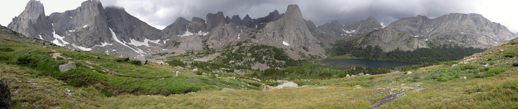
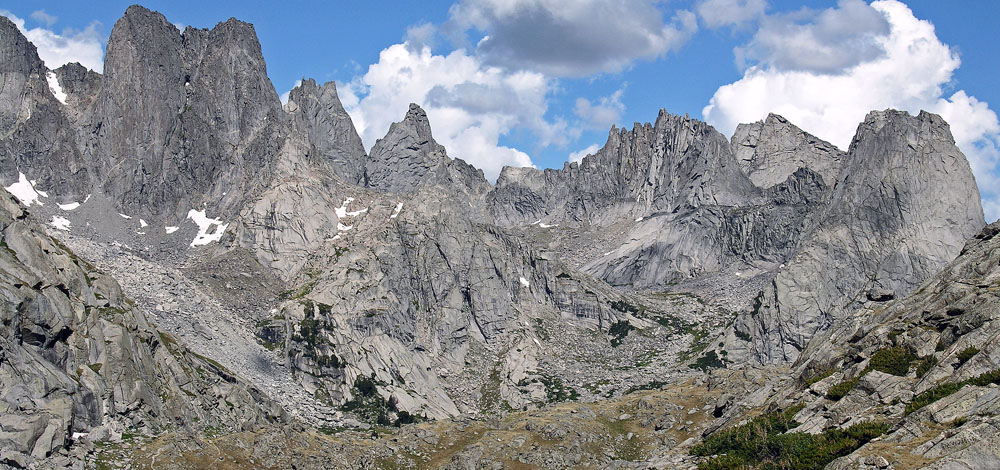
This panoramic shot of the Cirque of the Towers, was actually taken on our 3rd day out, but it just seemed like a good one to start with.
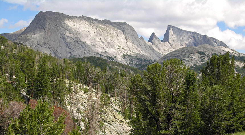
After an hour in the tent drying out and warming up, the weather finally cleared up for a good late afternoon hike. This shot of Haystack Mountain - left, Steeple Peak - center, and East Temple Peak - right, was taken looking east from the trail north of Big Sandy Lake. It was our first "ooh! - ah!" view of the trip.
For our scond day out, we hiked up to Clear Lake below Haystack Mountain, and on up to Deep Lake. This was a hike recommended to us a couple days earlier by a photagrapher coming out. We were amazed at how good the climbing looked along the west face of Haystack, and when we pulled out the Wind River guide book, we were able to identified quite a few of the awesome looking routes along the face.
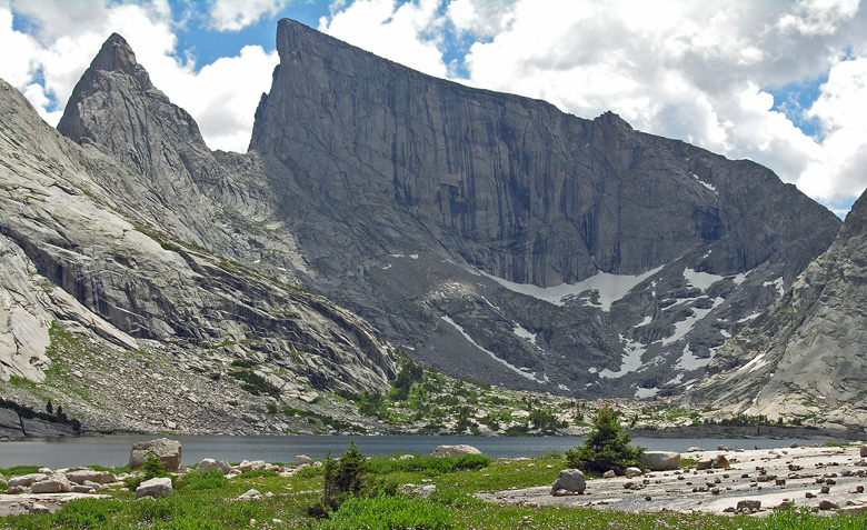
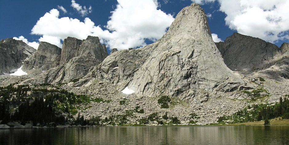
After getting this next picture of Steeple Peak and East Temple Peak from Deep lake, we headed back down.
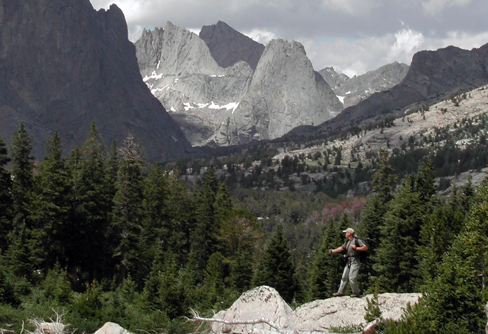
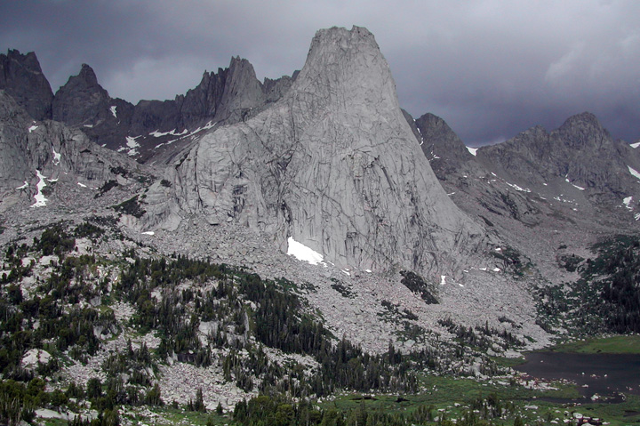
Not far down from Deep Lake, Suzy captured this shot, with me screwing around, looking out over Jackass Pass into the Cirque of the Towers, with Wolf's Head and Pingora Peak highlighted in the sun.
Suzy hurriedly snapped this close-up of Pingora Peak, with Wolf's Head behind and slightly left, as I was taking the panoramic series at the top of this page. It was our third day out, and we had hiked over Jackass Pass into the Cirque of the Towers, hoping to get a good look at the Northeast Face Route on Pingora, and the East Ridge Route of Wolf's Head: two of the routes noted in the book Fifty Classic Climbs of North America, by Steve Roper & Allen Steck. Once we got over the pass though, the storm-of-the-day moved in fast from the north. A minute or two after this shot was taken, rain mixed with hail started coming down, and with Suzy yelling, "I think we should get out of here!" Pingora took a direct lightning strike on the lower northeast corner. We made a speedy exit after that, taking the old - lower trail through Jackass Pass to minimize our risk in the storm.
One year later - August, 2006
Since the previous year's thunderstorm had forced our retreat from the Cirque of the Towers, just minutes after arriving, another hike to the Cirque was our first objective this year. As we came up over Jackass Pass, I took this shot showing, from left to right, Watchtower, Shark's Nose, Overhanging Tower, Wolf's Head, Bollinger Peak, and Pingora Peak. I wish I had a month, or more, to hike and climb in just this one area.
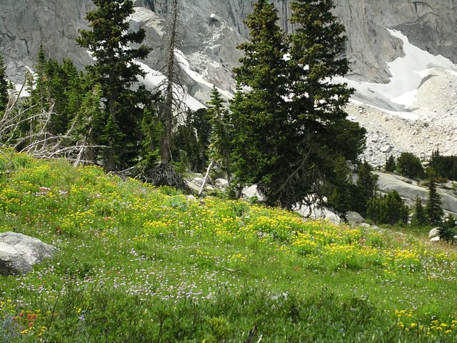
We couldn't believe how thick and beautiful the wildflowers were on the lower slopes as we descended from Jackass Pass. Apparently the Cirque, due to its shape I suppose, receives a lot more rain than the other areas we had explored.
Breaking for an energy bar lunch at Lonesome lake before heading back, we snapped a few photos of Pingora while we enviously watched some climbers, through our binoculars, completing the final pitches of the classic Northeast Face Route.

Climbing and Hiking the Wind River Mountains

Wind River Trails
Guide to the Wyoming Mountains and Wilderness Areas: Climbing Routes and Back Country
- Out of Print -
