


| » | » | » |
Having spent so much of my time playing in Colorado where mountains rise fairly gradually in comparison, the mountains in the Grand Teton National Park, north of Jackson Hole, Wyoming, really took me by surprise. They rise out of nowhere to over 7,000 feet above the valley floor at the top of the Grand Teton. Suzy and I were planning to climb the full Exum Ridge in August, and this was my chance to scout it out and see what I was getting into.
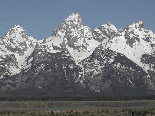
Taken Memorial Day weekend, 2003, from the highway east of the Grand, this shot shows just how radically the terrain changes from valley to mountains. From Left to right, there's the Middle Teton, The Grand Teton at 13,770 ft, Mt Owens, and Teewinot Mountain.
Ok; it's Friday, August 2nd, 2003, and it's time for the big adventure. With a 65 pound pack on my back, 7 miles and nearly 5000 feet of elevation gain to go to reach the Lower Saddle, we started up from the Lupine Meadows Trailhead. A word of caution: there's lots of bear in this country, and I found myself 15 to 20 yards from one only a mile or two up the trail, so be alert to the danger. Luckily, this bear was too busy enjoying the berries to give a damn about me.
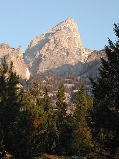
While this next shot of the Grand is one of the best I got during the trip, it's a view only seen from the trail leading to Amphitheater Lake; since we were supposed to be heading toward Garnet Canyon, this was a bad thing.
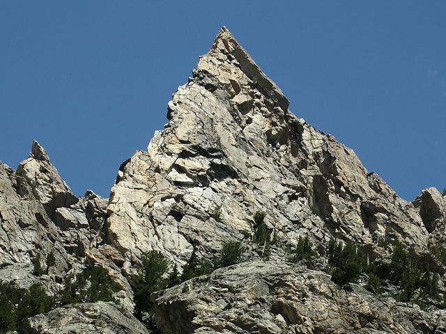
One hour behind schedule now, we finally arrived at the Meadows Bivy area in Garnet Canyon. Here, Irene's Arete can be seen looking up on the north side of the canyon. With 5 pitches of quality 5.7 to 5.10 climbing, this is high on my to-do list. This photo was actually taken in August, 2006 though; the resolution was better, using a newer camera, so I replaced the original shot.
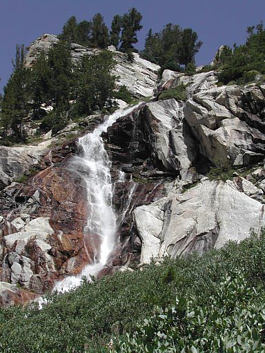
Spalding Falls is a beautiful sight, but symbolizes pain in my mind. Fill up all your water bottles before going any further; there's nothing but steep switchbacks from here on, and I had a hard time with dehydration. I actually had enough water, but it was a hot day, and I wasn't stopping often enough to drink. Suzy on the other hand was using a Platypus hydration system, allowing her to drink and hike at the same time, and did quite well. I learned something here.
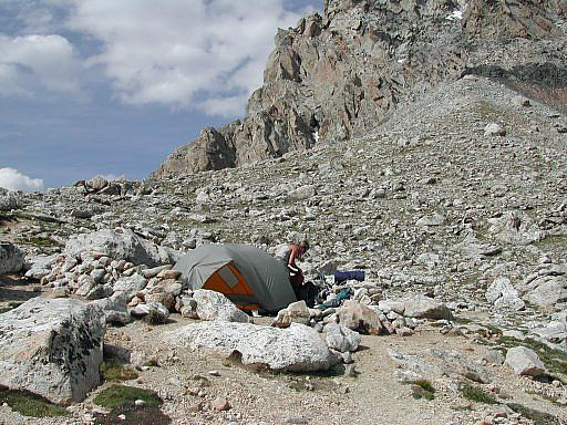
After struggling up the Headwall just below the saddle, with the assistance of a hemp rope left there by one of the guide services I believe, we arrived at the Lower Saddle bivy area. This is the highest bivy area available for this side of the Grand, topping out at around 11,600 feet. Although it's a long steep hump, it's also a great view looking both east and west, and I'm glad we toughed it out to get there. Suzy hates this tent (I won't mention the brand name), but it served the purpose. There's a water source up here too by the way.
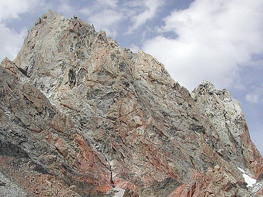
After setting up camp and getting something to eat and drink, we walked up to check out the start of the climb. We didn't want to waist time with this in the morning, and with the fatal accident on this route the week before ( Lightning kills 25-year-old Idaho woman), we really wanted to make good time once we got started to avoid any afternoon storm activity. As you can see from this shot of the Exum Ridge, and all the previous shots, the weather was great all day for our approach to the Lower Saddle; however...
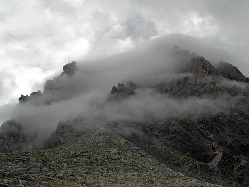
This is what we woke up to the next morning. We actually woke up at 5am (still dark) to drizzle, so we went back to sleep for a couple hours hoping for an improvement. At 7am the only improvement was that it was now light. Seeing our opportunity washed away, we packed up and headed back down. We figured it would be more fun playing around somewhere below than waiting it out in the tent all day. We'll try again next year.
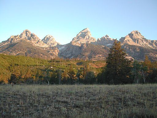
After one more day of bad weather, and a couple enjoyable nights at the AAC's Climbers' Ranch, we headed out and took this last picture at 6:30am Tuesday morning. As you can see the weather had improved for our departure. We really love this area and will probably make it an annual event. Once again, from left to right, there's Nez Perce, the Middle Teton, the Lower Saddle (our high point for the trip), the Grand Teton, Mt Owens, and Teewinot Mtn.

Teton Classics: 50 Selected Climbs in Grand Teton National Park
Climber's Guide To The Teton Range
Guide to the Wyoming Mountains and Wilderness Areas: Climbing Routes and Back Country
BN Out-of-Print Bookstore
