


| » | » | » | » |
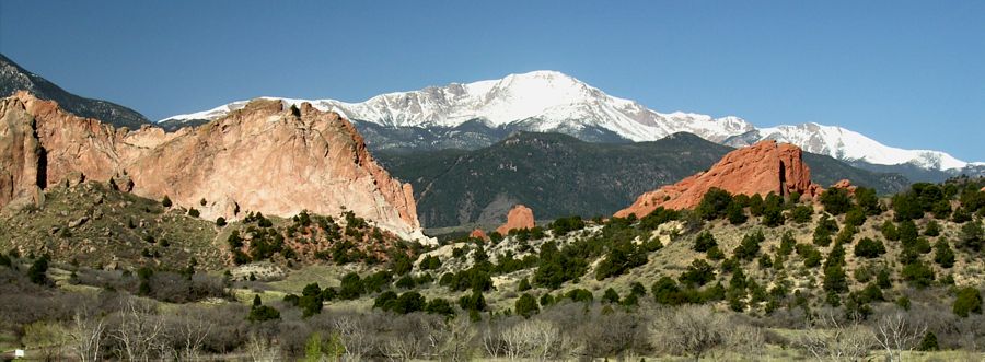
I took this shot of Pikes Peak from Colorado Springs' Garden of the Gods visitors center in April of 2007; however, it was back in July of 2003 when Suzy and I hiked to the summit from the Manitou Springs trailhead, via the " 26 mile round trip" Barr Camp trail. Although, the ascent is only rated "class 1" (non-technical hiking), the elevation gain is a demanding 7,400 feet.
After struggling for some time trying to decide just how to do this, camping on the way up or on the way down and when to hit the trail, we finally decided just to do the whole thing in one long push. Also, to make it even more interesting, we decided to hit the trail at 8pm Friday evening and hike the whole way up using headlamps. We planned to eat breakfast on top at the restaurant & gift shop, and then head back down during the day. It just seemed logical to hike up during the cool night and save the daytime heat for the trip down.
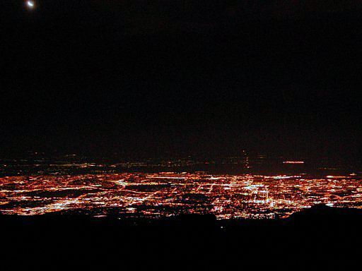
With very little to photograph in the dark of the night, I took my first shot from the top of Pikes Peak, looking down toward Colorado Springs at 4:30am with a 1/4 moon in the upper left corner attempting to shine through the haze. We reached the top at 4:15am, and with nearly 4 hours to wait for breakfast, we found an out of the way spot, pulled out our lightweight sleeping bags, and got a couple hours sleep. Even though it was only 36F at the peak when we arrived, we still slept like rocks, on the rocks.
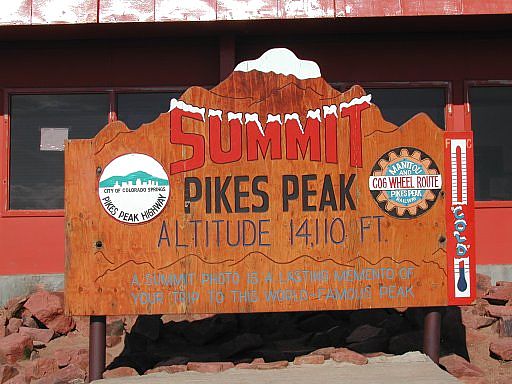
It's 8am now, and after a five minute attempt to look presentable, I took this shot of the summit sign as we went into the restaurant & gift shop. I am using the term restaurant loosely though; we had visions of omelets in our heads, but ended up with plain doughnuts (fresh at least) and coffee instead.
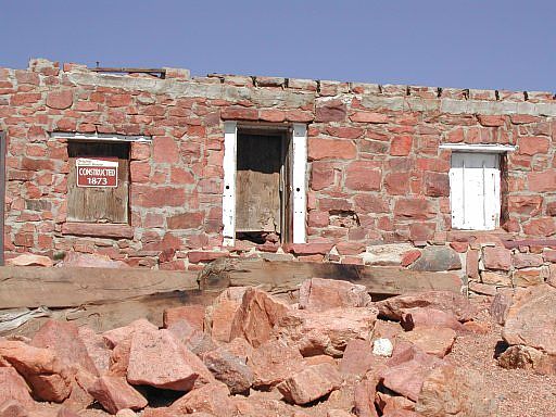
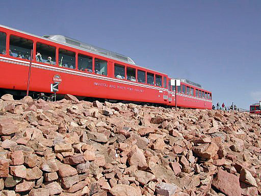
After inhaling 4 doughnuts, including one of Suzy's, and buying Pikes Peak shirts, we started back down at 9:20am. As we crossed the COG rail tracks I nearly overlooked the original summit hut.
We were getting off the peak just in time as the 1st
COG rail train
of the day, full of cattle tourist, pulled up. This peak is different
from most in that, with a road and a rail to the top, you're rarely alone when you get
there; however, at 4am, you do actually have some solitude, since both the road and rail
are closed at night.
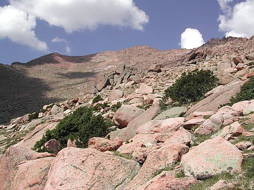
After passing a hundred or so gasping hikers and runners on the trail (only saw one other person all night on the way up), I stopped at tree line to take this shot of the peak. The Pikes Peak Marathon was coming up, and the runners were getting in some pre-marathon conditioning; although, I think the whole idea is sick!
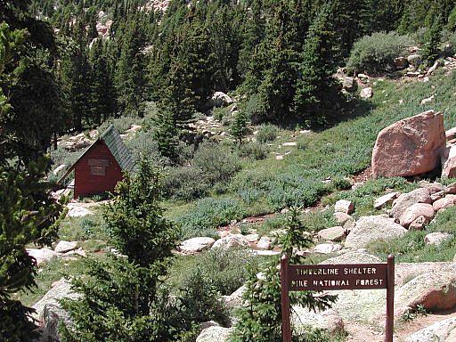
A little further down the trail, we passed the Timberline Shelter.
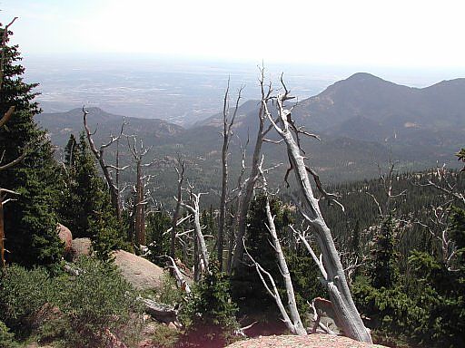
Somewhere between the Timberline Shelter and Barr Camp, I stopped to take one more shot (in the light this time) toward Colorado Springs. I've always thought dead trees added character to a picture, so this was a good spot to shoot from.
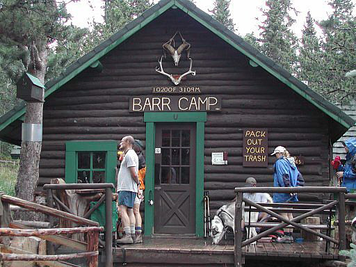
Just prior to reaching Barr Camp, an afternoon storm hit. The first blast of thunder nearly had me diving for cover. That crisp crack preceding the boom really emphasizes that you're way too close. So, we took a break in the Barr Camp main cabin to wait out the bulk of the storm before starting the last leg of the trip.
One advantage to hitting the peak so early in the morning was that we would be far from the summit during any afternoon storm activity; however, only two or three miles from the trailhead, we passed a tree that had very recently been blown apart by a lightning strike. Just five feet off the trail, it proves that you're never really completely safe in this regard. Had anyone been passing on the trail at that time, they probably would have died. I really should have taken a picture of the tree, but at that point, I was too focused on getting back to the trailhead, and into the cooler of beer we had waiting there.
Anyway, with a cold one in hand by 4pm, we determined that start to finish took about 20 hours with a 5 hour holdover on the peak which included a good 2 hours of sleep. I don't think we could have had a better time doing it any other way. The thought of staying at Barr Camp was tempting, but the opportunity to hike from the trailhead to the peak in complete solitude was also very unique, since this is one of the most visited mountains in the world.
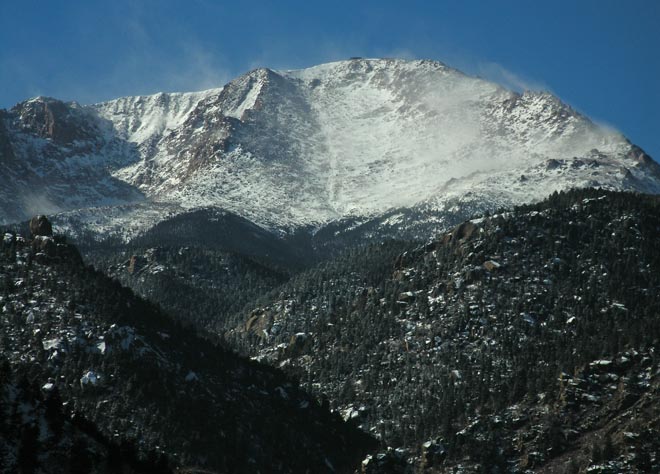
Saturday, December 22nd, 2007, Suzy and I were playing around in the Springs on the 1st sunny day following a minor snowstorm, and Pikes Peak looked cool with fresh snow blowing around the summit. I took this zoomed in shot from Manitou Springs, a couple miles east of the Barr camp Trailhead. The top of the summit giftshop is visible if you look close.
Colorado's Fourteeners: From Hikes to Climbs
Colorado's Fourteeners: Companion Map Package with Cdrom and Map
A Climbing Guide to Colorado's Fourteeners
The Colorado Mountain Club Pocket Guide to the Colorado 14ers
Dawson's Guide To Colorado's Fourteeners - Vol 2
Rocky Mountain Rock Climbs (Climber's Guide to North America)
- Out-of-Print book -
- Good info on Pikes Peak technical routes -
