


| » | » | » | » |
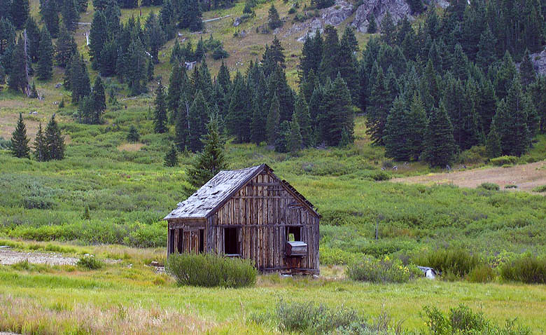
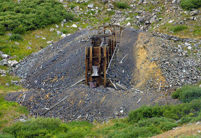
We've bagged nearly fourty of Colorado's fifty-four official 14,000 foot peaks to date. Discouragingly though, the drive to the remaining peaks has become too much for a simple two day weekend. While we've loosely scheduled longer trips to get these peaks, time has slipped by, and it's now been two years since we've summitted our last 14er. Suzy, wanting to climb something, suggested doing some of the closer peaks again by different routes. So, with that in mind, Saturday, August 29th, 2009, we ascended Grays Peak by the East Slopes Route, from the Horseshoe Basin Trailhead. As we geared up at the trailhead, I took this shot of the old Shoe Basin Mine cabin.
As we started off, Grays Peak was not visible, but just 15 minutes or so up the trail, it started coming into view.
In line with the East slopes now, we could see one of the two parties ahead on the hill directly in front of us.
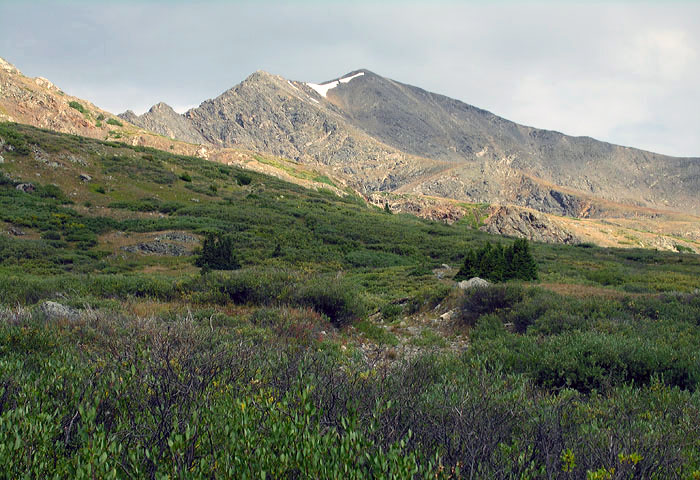
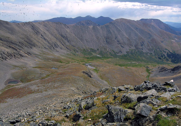
At the top of the first hill ourselves now, all of the remaining East Slopes stretched out in front of us. The route looked good, but the trail itself got a little questionable at this point. I thought I saw a cairn just up the trail from where I took this shot, and wondered if we should be cutting more directly up the slopes at that point. There wasn't even a faint trail to go with that cairn though, so we stuck to the obvious trail which circled around the hill to the right, on the north side of the slopes. This trail eventually seemed to go right up the loose south side of the East Ridge. While we knew of no route up to the ridge from this side of the peak, both parties ahead continued up that way. Hearing multiple rock slides set off by the first party, we circled back around to the East Slopes. An occasional small cairn seem to provide a hint of direction now, but there wasn't an obvious trail until we go up to the steeper terrain approaching the Southwest Ridge.
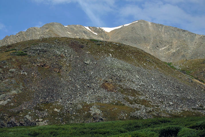
When we reached the Southwest Ridge, I stopped to get this picture looking back down at the East Slopes and Grays' long East Ridge, which is actually part of the Continental Divide. The first party that "was" ahead of us had finally made the East Ridge; however, they were now quite a ways below us and would not summit until we were well on our way back down. The second party had probably decided the ridge slope was more than they wanted, and had turned back. I didn't know it until we got home, but this picture caught the end of a huge flock of birds that zoomed by us right then.
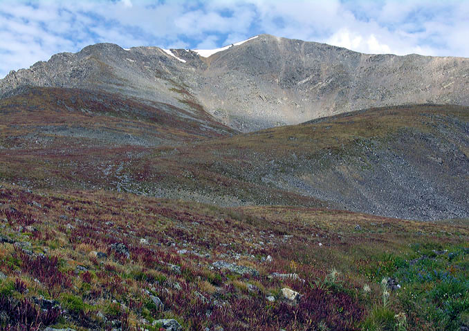
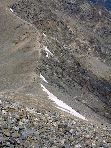
Working up the Southwest Ridge, as we came over the East Ridge, We were shocked to see all the people ascending from the Stevens Gulch Trailhead. Between the Grays' East Ridge and Torreys' Kelso Ridge, there could have been a hundred or more summiteers scattered about. Being the first to summit that day via the East Slopes, and passing only three others on their way up as we descended, made this an extremely enjoyable day. Except for our short stay at the summit, we had completely avoided the crowds.
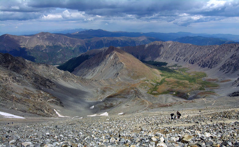
Taken from the summit, this shot looks down the North Slopes Route, with Torreys' lower Kelso Ridge on the left.
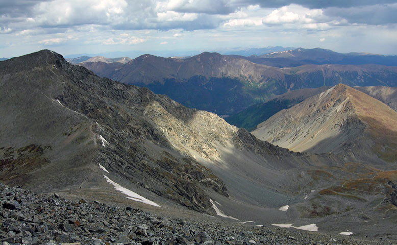
This view of Torreys Peak and Kelso Ridge shows what I think is probably one of the best 3rd class routes on any of Colorado's 14,000 foot peaks. Weather was coming in quick though, from the northwest, so we turned right back around and didn't stop to eat until we were back on the East Slopes.
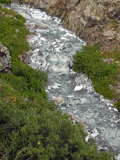
The weather never got too bad, but we did have some brief moments of wind and snow pellets, turning to periods of light rain further down. Back on the 4x4 road at the foot of the peak, I pulled the camera out again for a shot of another old mine. Every time I see one of these, vivid images of the old west, and its hardships, pop into my head.
Sadly though, these old mines have left scars on the land that will take who knows how long to heal. Below the mine, shown above, this stream's rock bed has been bleached completely white from the mining process that took place all those years ago.
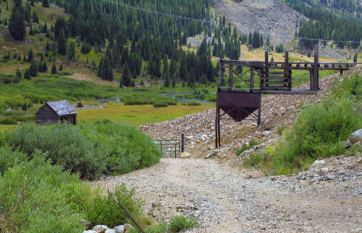
The Shoe Basin Mine, with the trailhead just around the corner, made a good closing trip photo. Climbing Kelso Ridge and tagging both Torreys and Grays Peaks from the Stevens Gulch Trailhead, especially with the many Mountain Goats in the area, is a 14er combination with few comparisons; however, the peaceful East Slopes Route up Grays is a great way to escape the crowds. The down side being that tagging Torreys from this route requires ascending Grays a second time on the way out.
Colorado's Fourteeners: From Hikes to Climbs
Colorado's Fourteeners: Companion Map Package with Cdrom and Map
A Climbing Guide to Colorado's Fourteeners
The Colorado Mountain Club Pocket Guide to the Colorado 14ers
Dawson's Guide To Colorado's Fourteeners - Vol 1
