


| » | » | » |
In April, 2002, Ben (Gnorga) of Cheyenne, Wyoming, and I drove over to the Colorado National Monument at Grand Junction, Colorado, to climb Otto's Route ( 5.8+) on Independence Monument. This "Classic" climb is probably the only one of its kind - dominated by chipped holds. On the first ascent, John Otto pounded or drilled out hundreds of holes in the sandstone, creating a pipe ladder all the way to the summit. The pipes are no longer there, but the scars remain. While this would be completely unacceptable by today's standards, ironically we have John Otto largely to thank for the establishment of the Colorado National Monument back in 1911.
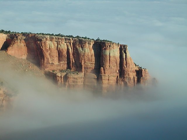
Anyway, Ben and I arrived at the Visitor Center late Friday afternoon, in the rain. When we questioned the park ranger regarding any concerns or possible restriction on climbing wet rock, we were told that the sandstone dries out very quickly, and there was no recomended dry out period prior to climbing. Somewhat surprised, we thanked him for the info and left. Moving on, we set up camp, ate dinner and had a few beers while it continued raining. With morning came clear blue skys though, so after breakfast we casually strolled over to the edge of the cliffs surrounding the campgrounds for a view to go with our coffee. Seeing a low fog roll up from the valley into the park, we were completely awed as it swallowed up everything below us.
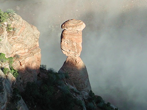
I hadn't done my homework prior to the trip, so when I looked down and saw Balance Rock with the fog rolling up under it, I was completely blown away. I've never had a better cup of coffee!
We continued along the edge of the cliff, from the west to the east side of the campgrounds, snapping up the photos until the fog finally lifted. As our photographic frenzy came to an end, I was shocked to see how much time had slipped by. Weather conditions were perfect now, so we grabbed our gear and raced down to the trailhead. We still had a good hike ahead of us before we could start the climb.
The lower half of the route, on the shaded north-west side of the formation, was uncomfortably cold and clammy this morning, and as much as I wanted to get through it as fast as possible to the sunshine higher up, my lead through the 2nd pitch off-width sucked. The only thing that kept me from turning the lead over to Ben, was his unwillingness to take it. We had previously decided that pitch two was mine, and my struggle did nothing to change his mind.
Soaking up the sunshine at last, Ben's lead up the final pitch slab was impressive, as he slid cams into Otto's pipe holes to ease the runnout up to the tricky last moves.
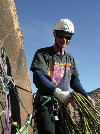
We summitted around 2:30pm, a good two to three hours later than we had hoped. Before rappelling back down though, I took one last shot of Ben, whose smile spoke for both of us.
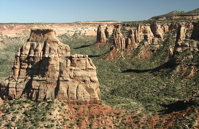
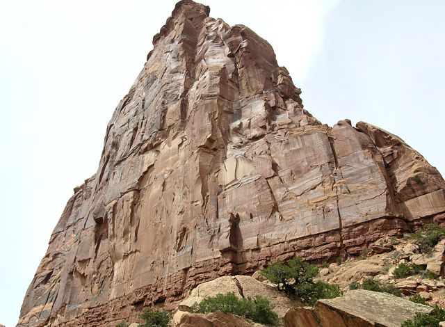
Four years later now, April - 2006, my wife, Suzy, and I came back to the park for a couple days of hiking and photography. This shot of Independence Monument, taken from the Canyon Rim Trail, also shows Grand View Spire, Kissing Couple and Dirty Old Man Tower, and Rainbow Tower in the background.
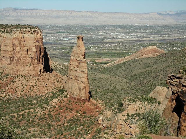
Looking east from the viewing platform at the end of Otto's Trail, Independence Monument stands tall with Grand Junction in the background.
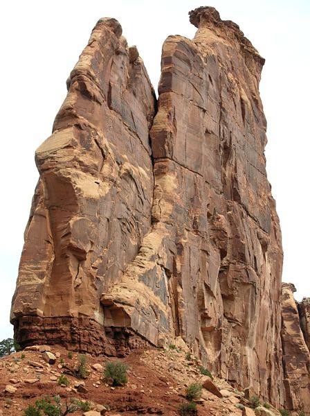
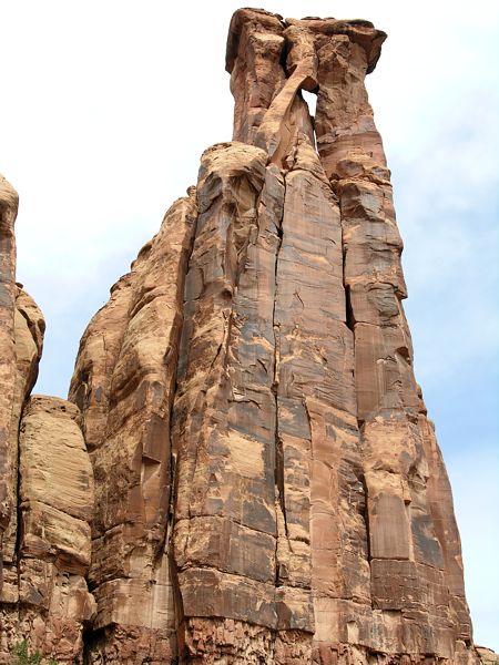
On our second day in the park, Suzy and I hiked down into Monument Canyon from the upper trailhead. This is a great trail with lots of photo opportunities, so it was going on 1pm when we finally reached Independence Monument. Independence Chimney (below), on the west side of the South Face, has been on my climbing wish-list for a few years now, so it was good to get a close-up look at it.
Seeing anchor webbing about one hundred feet up on the south face of Independence Monument, I grabbed this shot to compare with the guide book route descriptions. This face is home to the hardest climbs on the formation.
The southeast face of Kissing Couple, AKA Bell Tower, looked to me like a great climb: difficult of course. I looked it up when I got home, and I think the route is called "Big Hetti" ( 5.11 - R X), 360 feet (110 m). Guess I won't be taking in that view anytime soon.
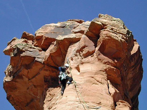
Showing good form on an unknown slab route, this soloist pauses for a photo shoot.
In the friendly competition between Suzy and I, while we hiked, over who would capture the best creative image, I lost. Although my shots, with better equipment and editing software, came out looking sharper, Suzy had the creative eye. some of my best photos throughout the day, were close simulations of scenes she visualized and shot first. In the shot below, other than a slight change of angle to create the sun star, the composition belongs to her. I never claimed to be an artist.
Desert Rock III: Moab to Colorado National Monument
Rocky Climbing Colorado
